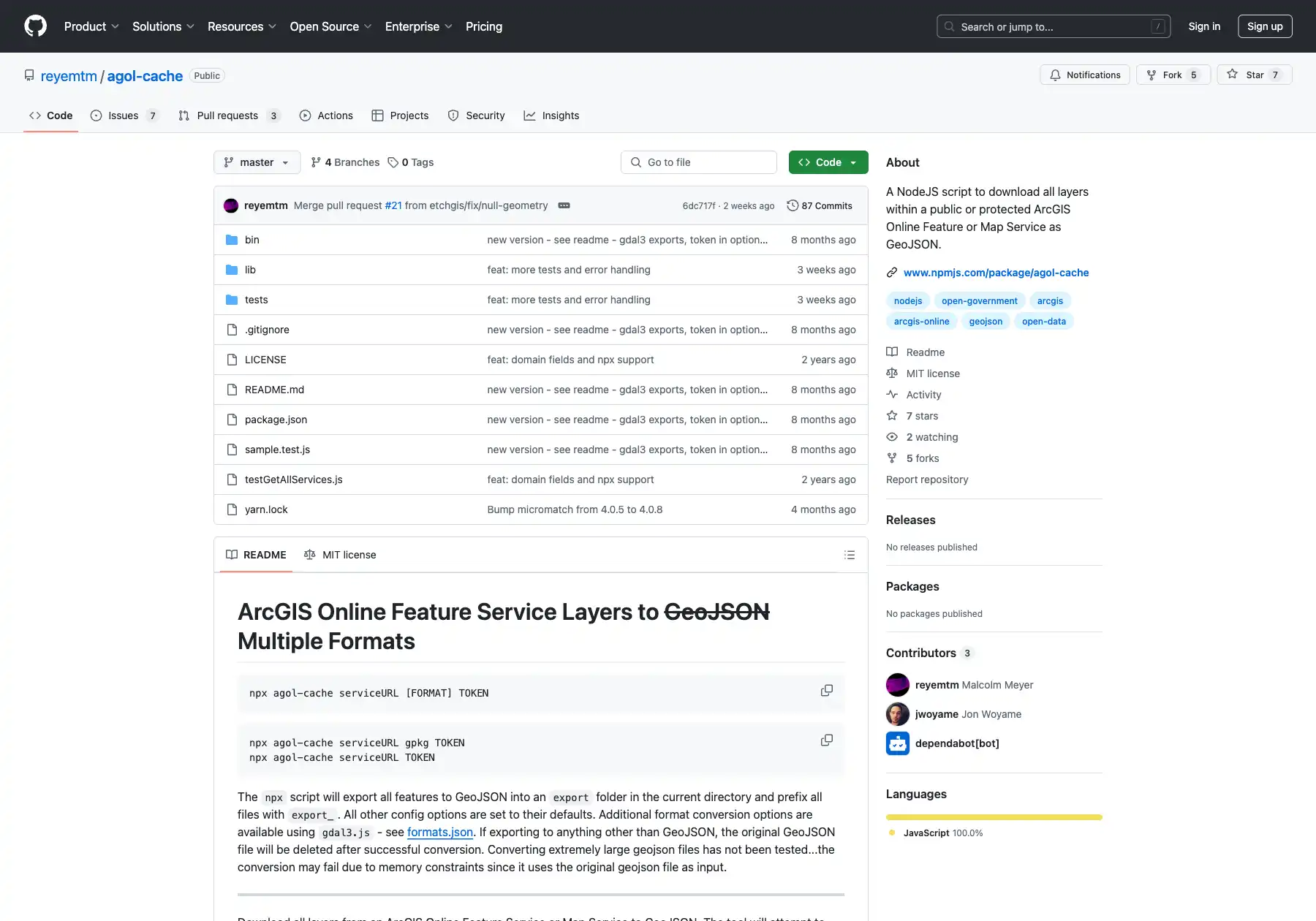
agol-cache
Client Project | A command-line and NodeJS tool for exporting
ArcGIS Feature Services to GeoJSON.
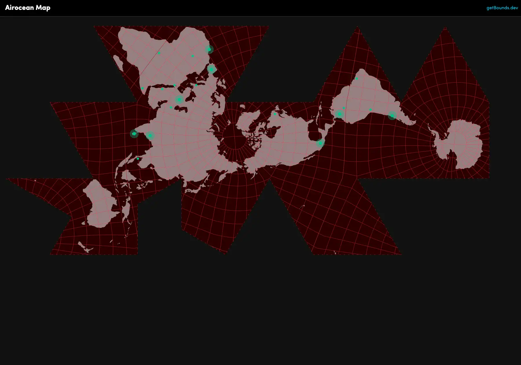
Airocean Projection Map
Forked from Observable with added mouse events, inspired by
Progressive International.
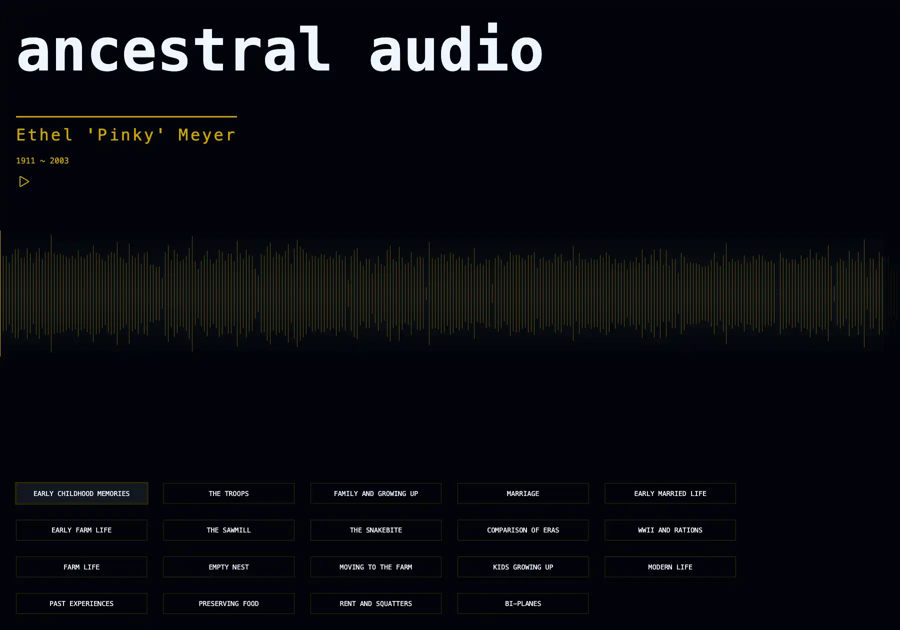
Ancestral Audio
A data visualization of an audio interview with my gradmother.
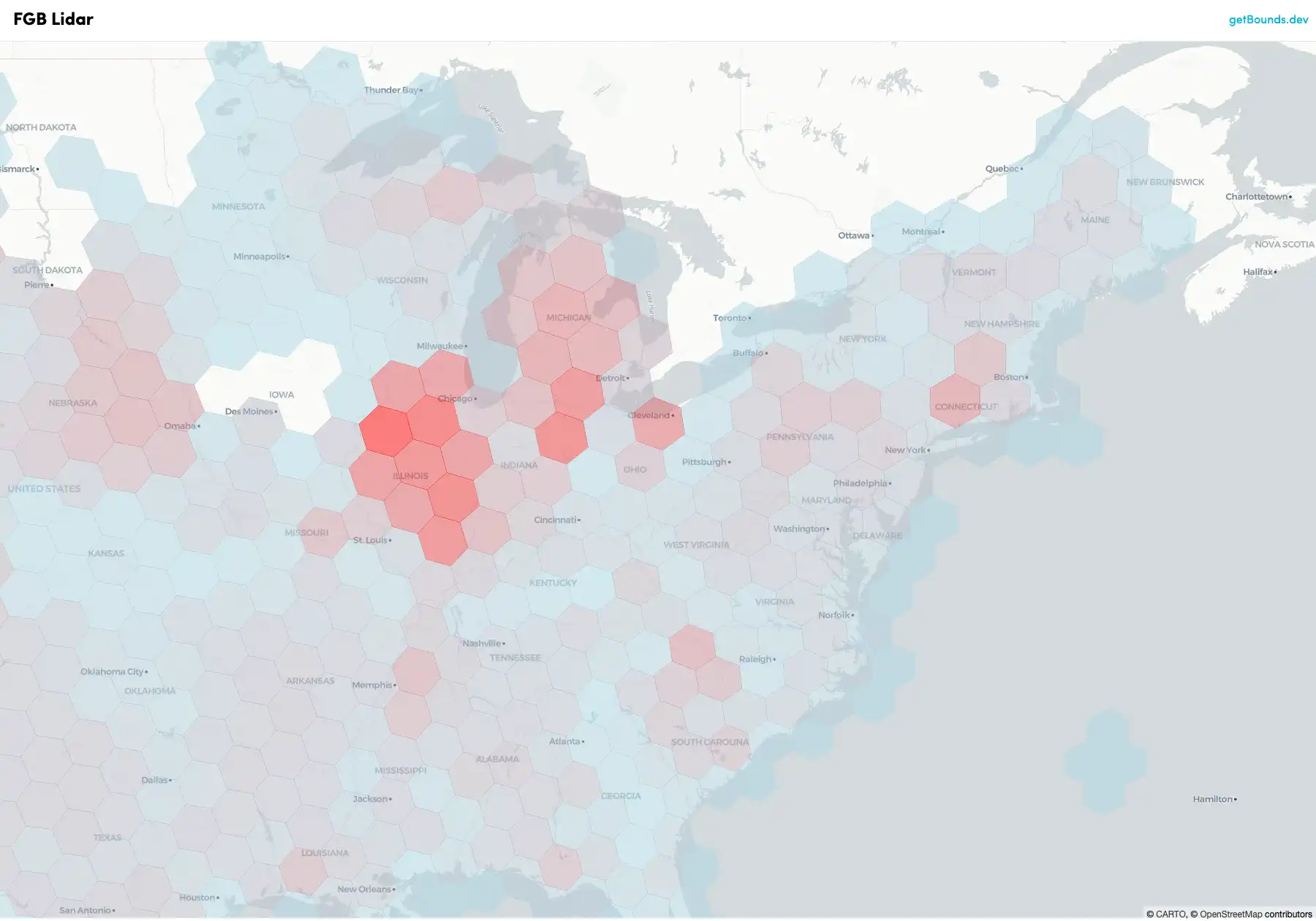
Flatgeobuf h3 Grids
Small-scale spatial data indexed to h3 grids and served via
Flatgeobuf.
FlatGeobuf Web Map
A web map using vector tiles generated on-the-fly from a
flatgeobuf file.
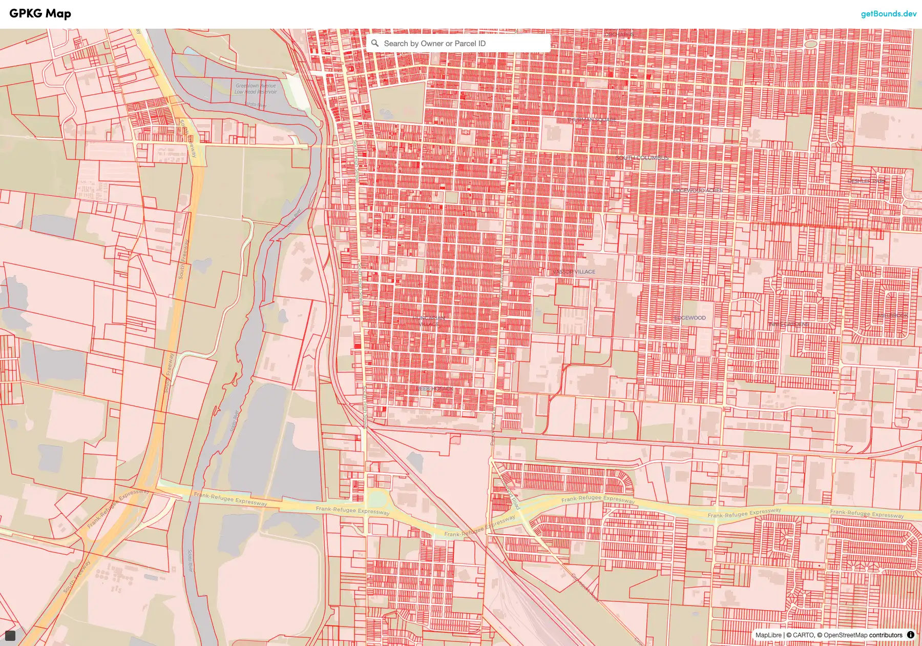
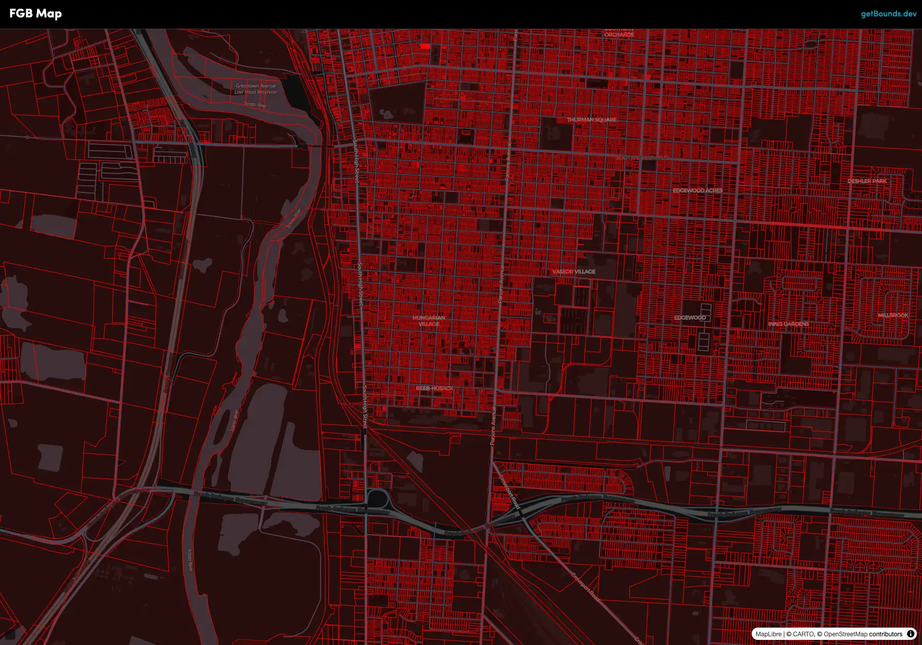
Geopackage Web Map
On-the-fly vector tiles plus text search from a 6.3 GB geopackage
file.
getBounds
My GIS tech blog.
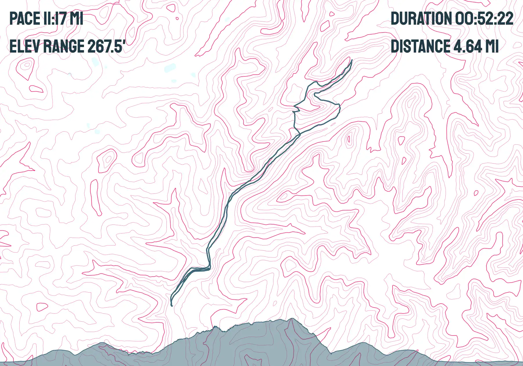
GPX Visualize
A tool for visualizing GPX files on a map.

MapCompare
Vector tiles and GeoTIFF rendering in four different mapping
libraries.
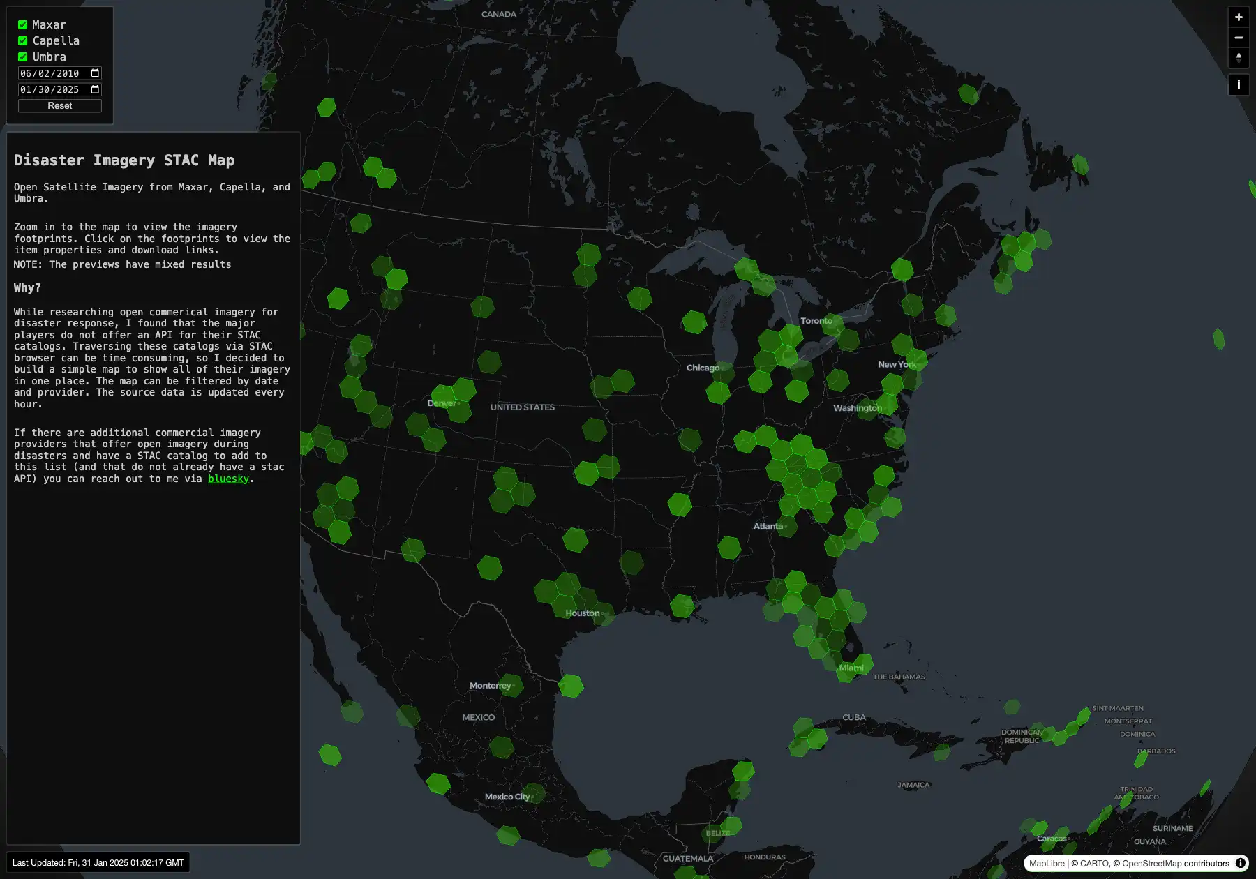
Mapping Disasters
A map visualization of open satellite Imagery from Maxar, Capella,
and Umbra.
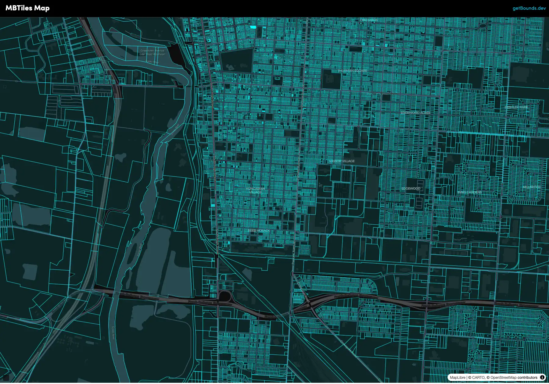
MBTiles Web Map
A web map using vector tiles served from mbtiles.
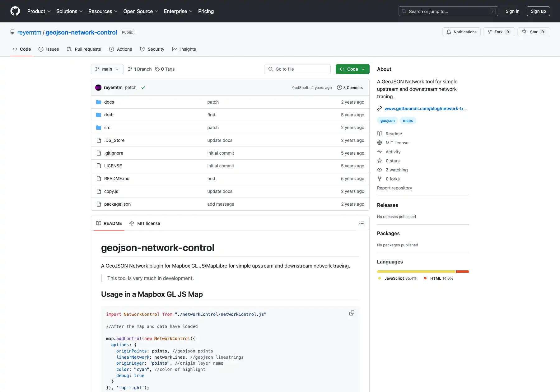
Network Trace
A mapbox-gl-js plugin for running simple linear network traces.
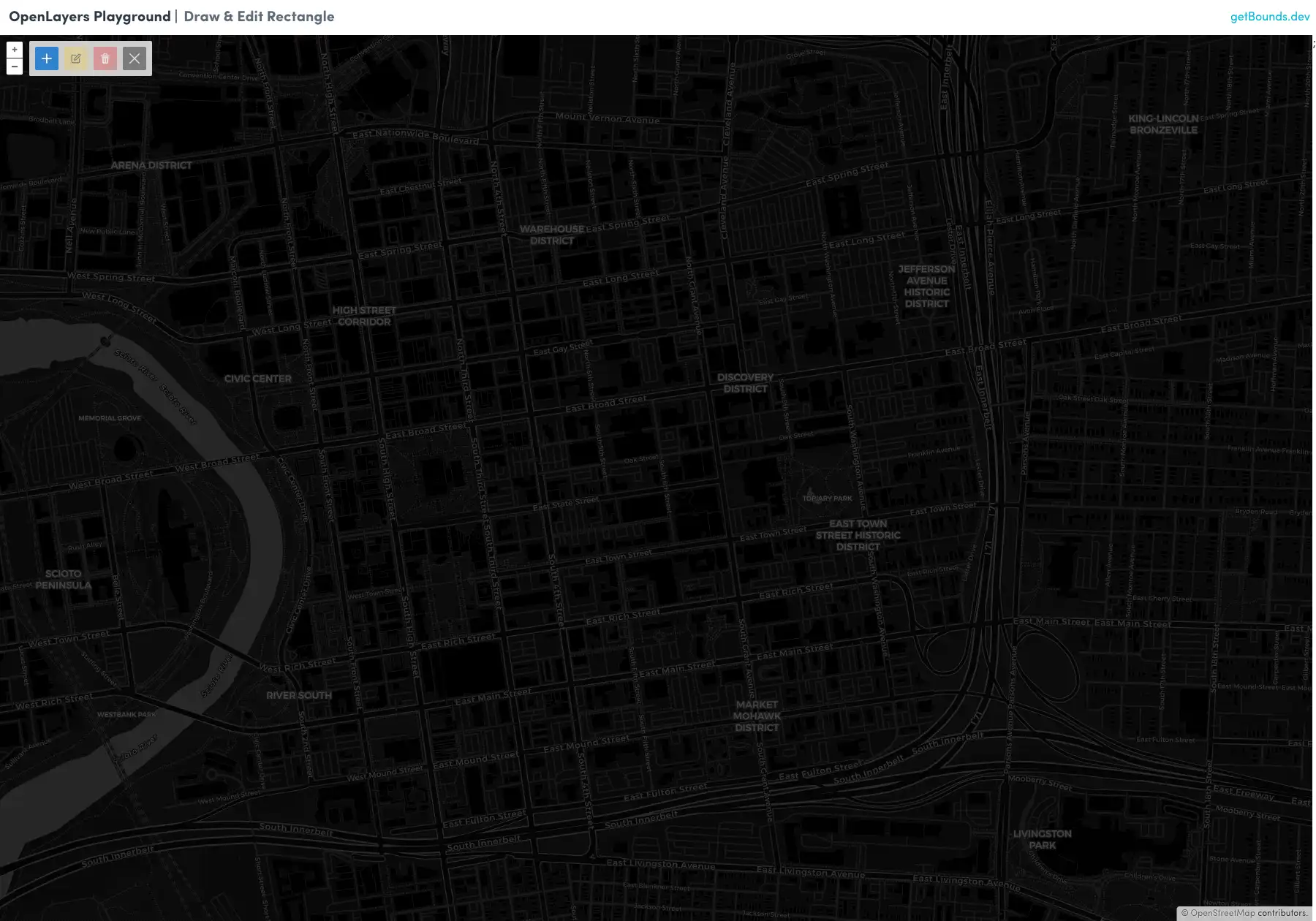
OpenLayers Draw & Edit Toolbar
A React Toolbar for drawing and editing rectangles (bounding
boxes) in OpenLayers.
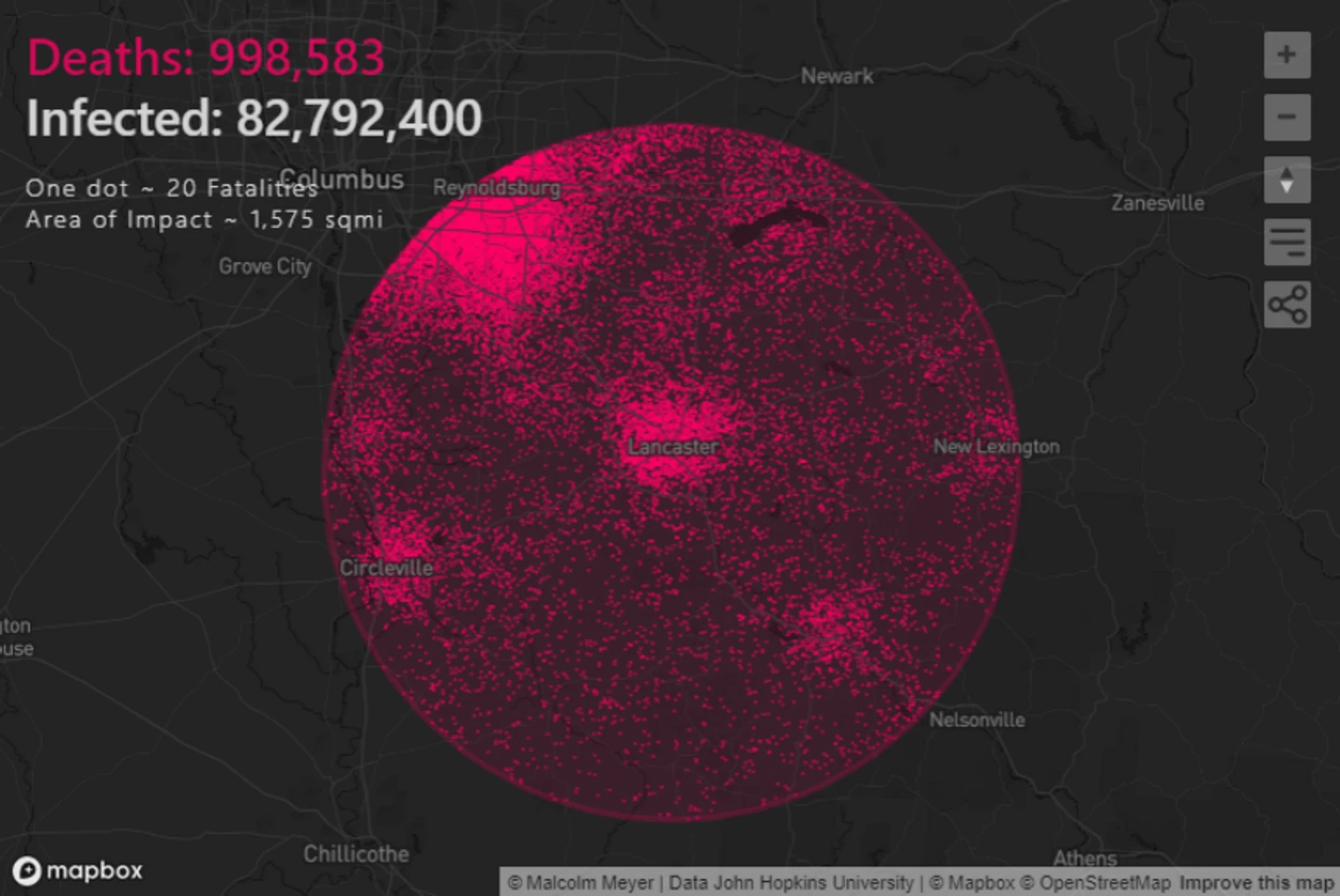
Pandemix
A map-focused data visualization of COVID-19 cases in the US.
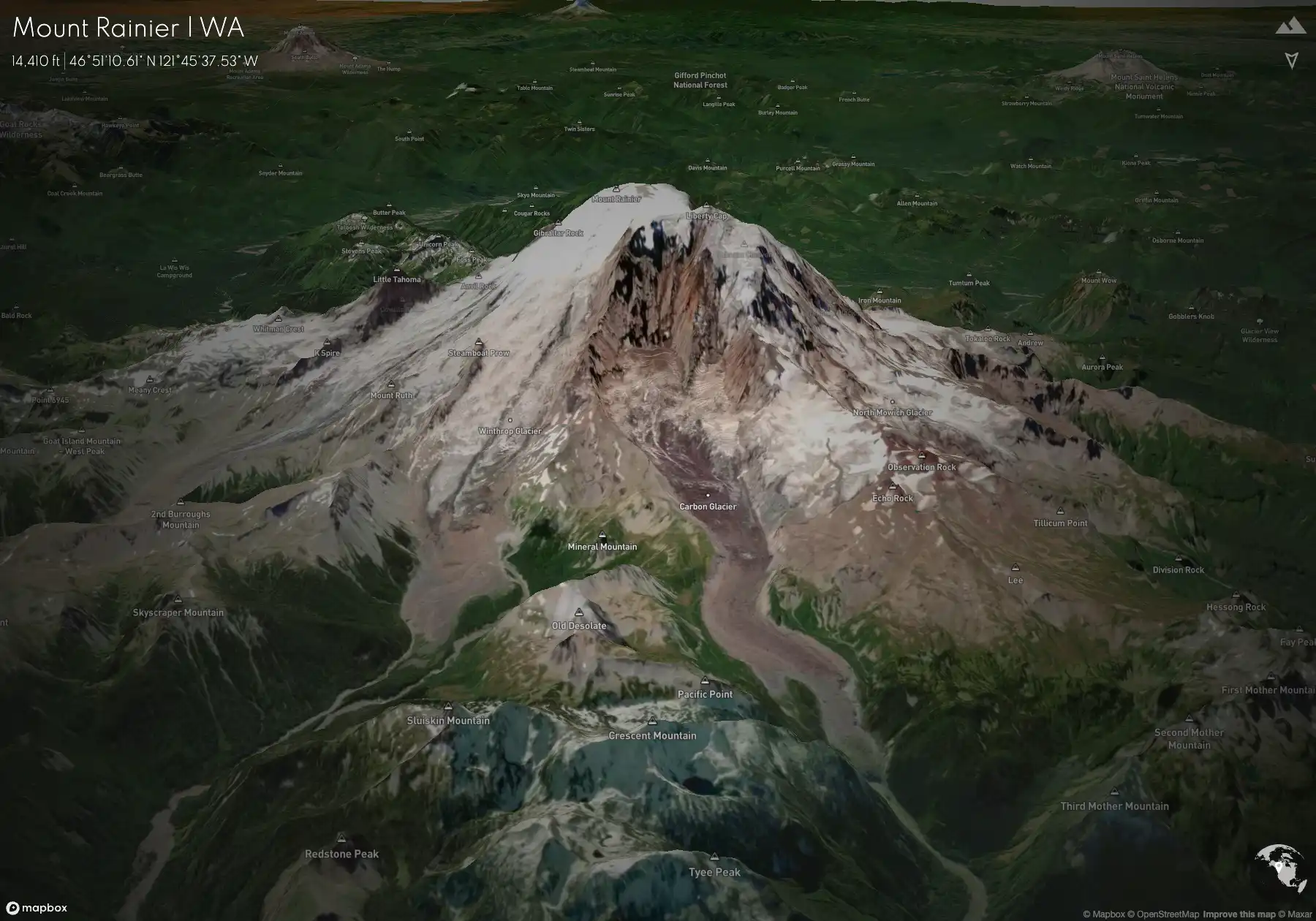
Peaks
A visualization of the highest peaks in each state in the US.
Potocki Vodka
Client Project | Map-focused store finder for a vodka brand.
Serverless Maps
A web map using service workers and sqlite (wasm) to load raster
and vector tiles from object storage.
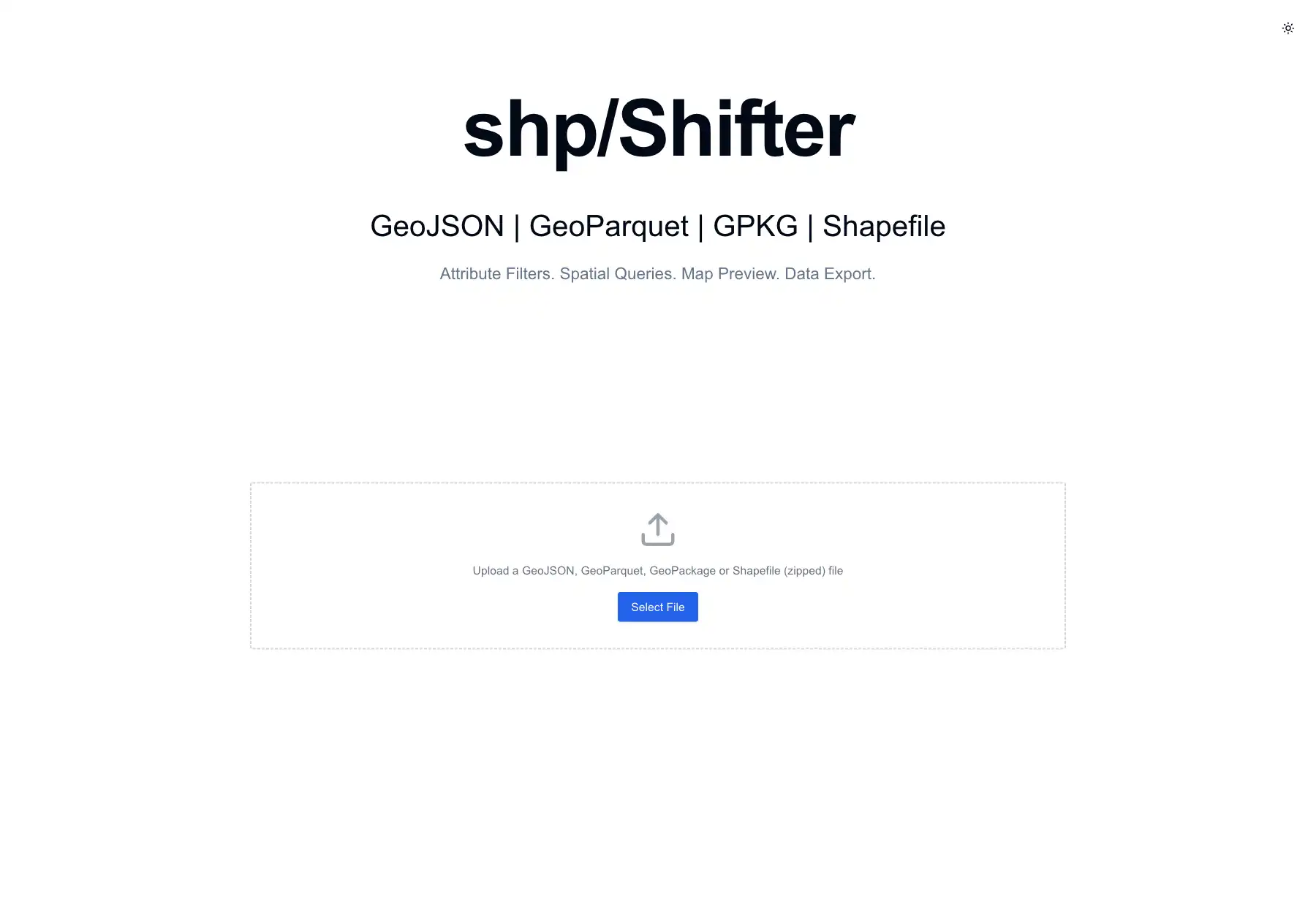
shp/Shifter
A tool to quickly filter a variety of spatial formats in the
browser and export them to GeoJSON.
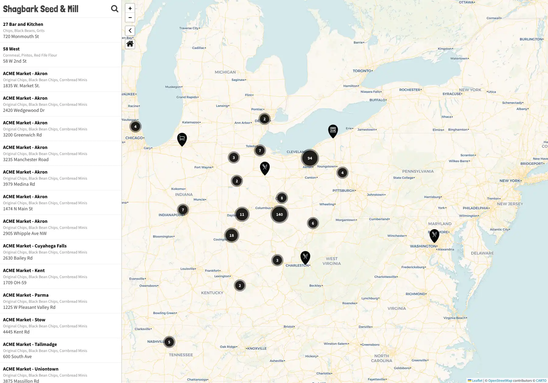
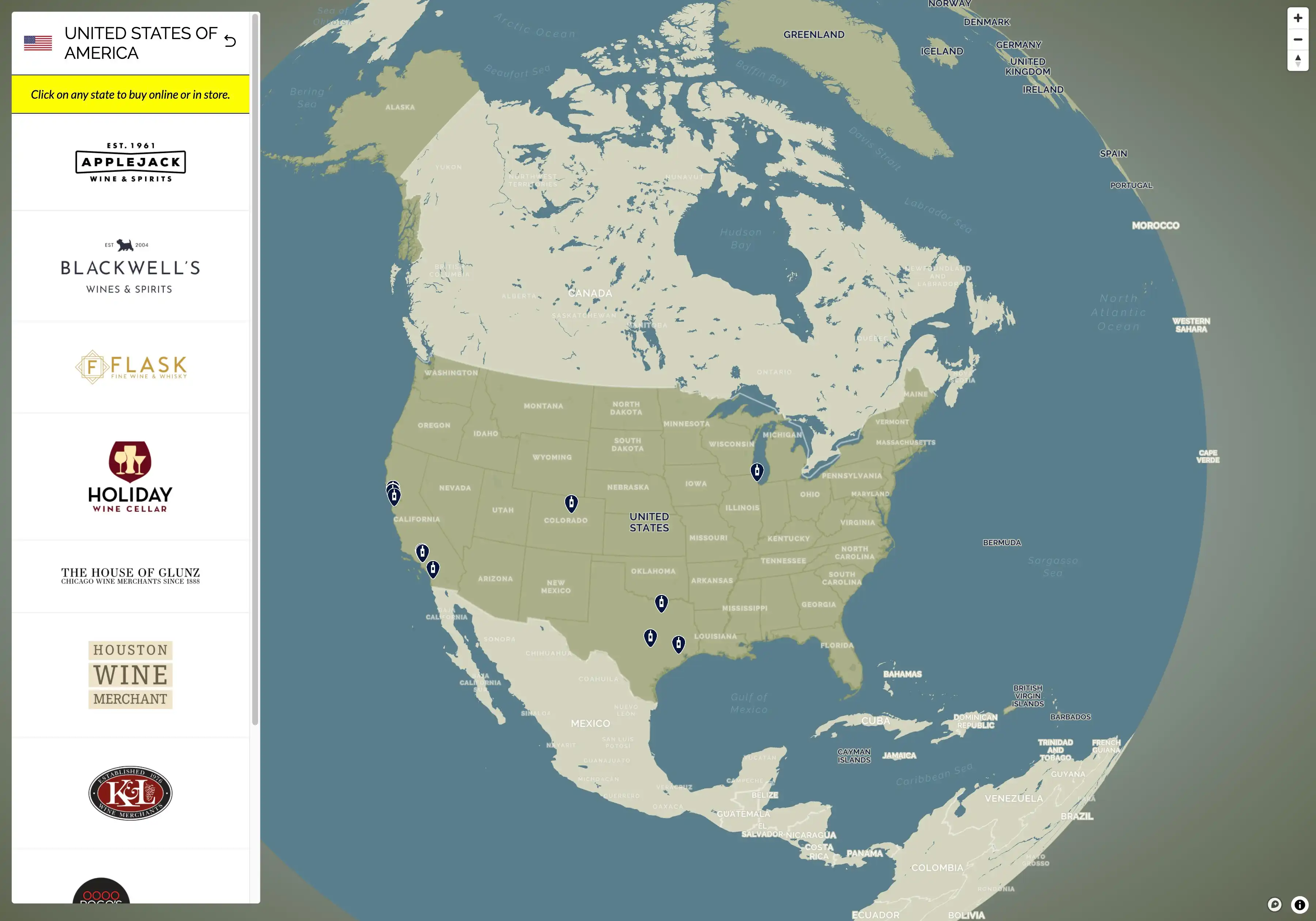
Store Finder
Client Project | A map-focused store finder.
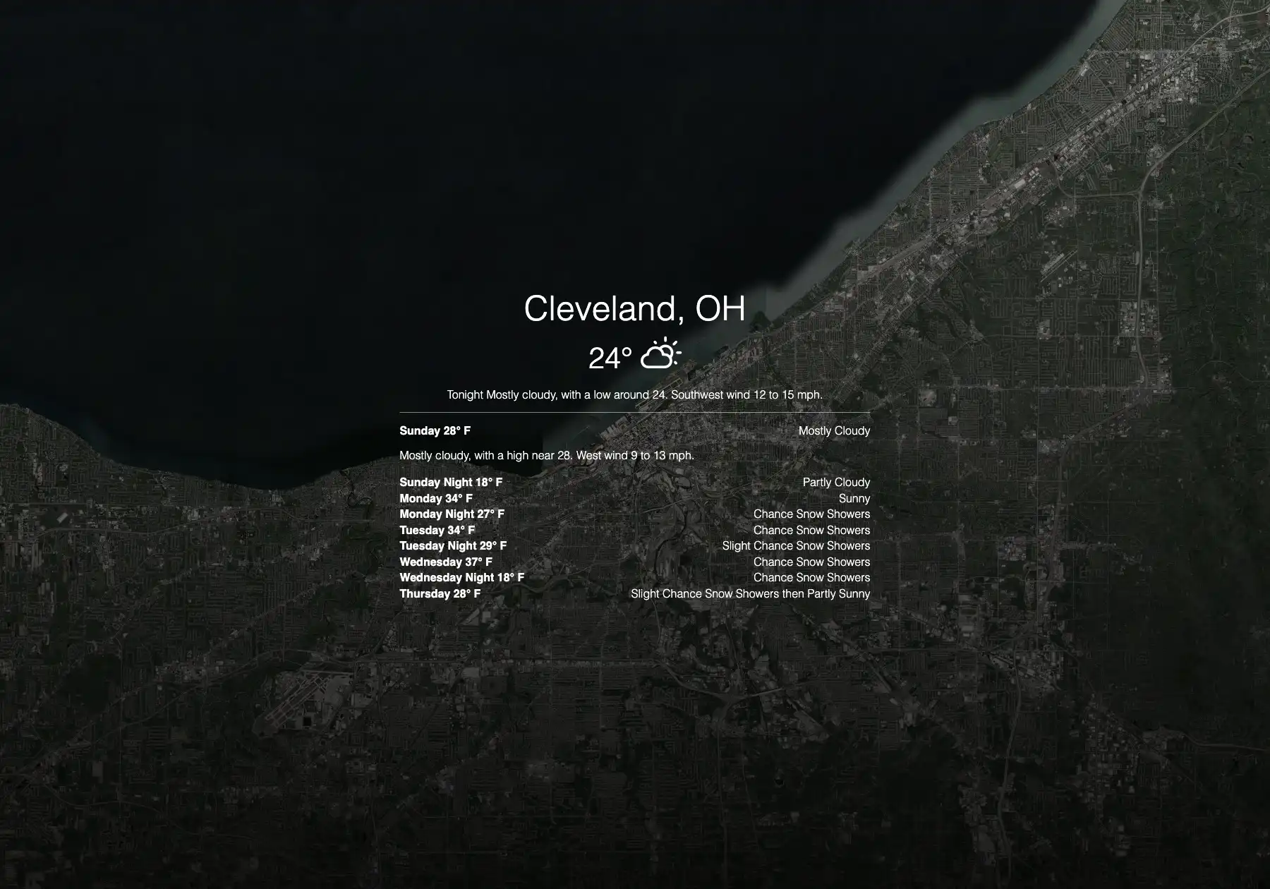
The Forecast
A weather app with a map backdrop that uses the National Weather
Service API.

Tilequery
A JavaScript tool for querying vector tiles.
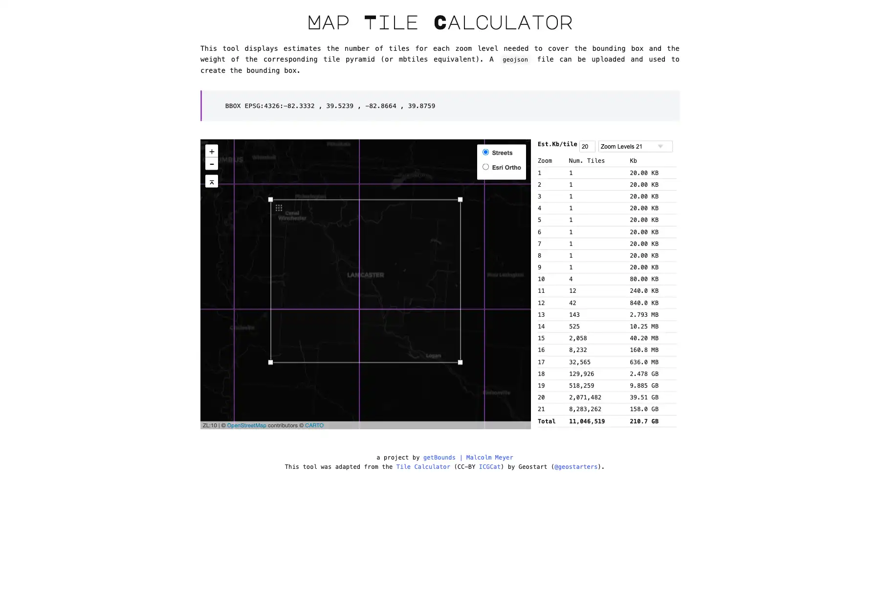
Tilesize
A tool for calculating the size of a tree of web map tiles in
bytes.
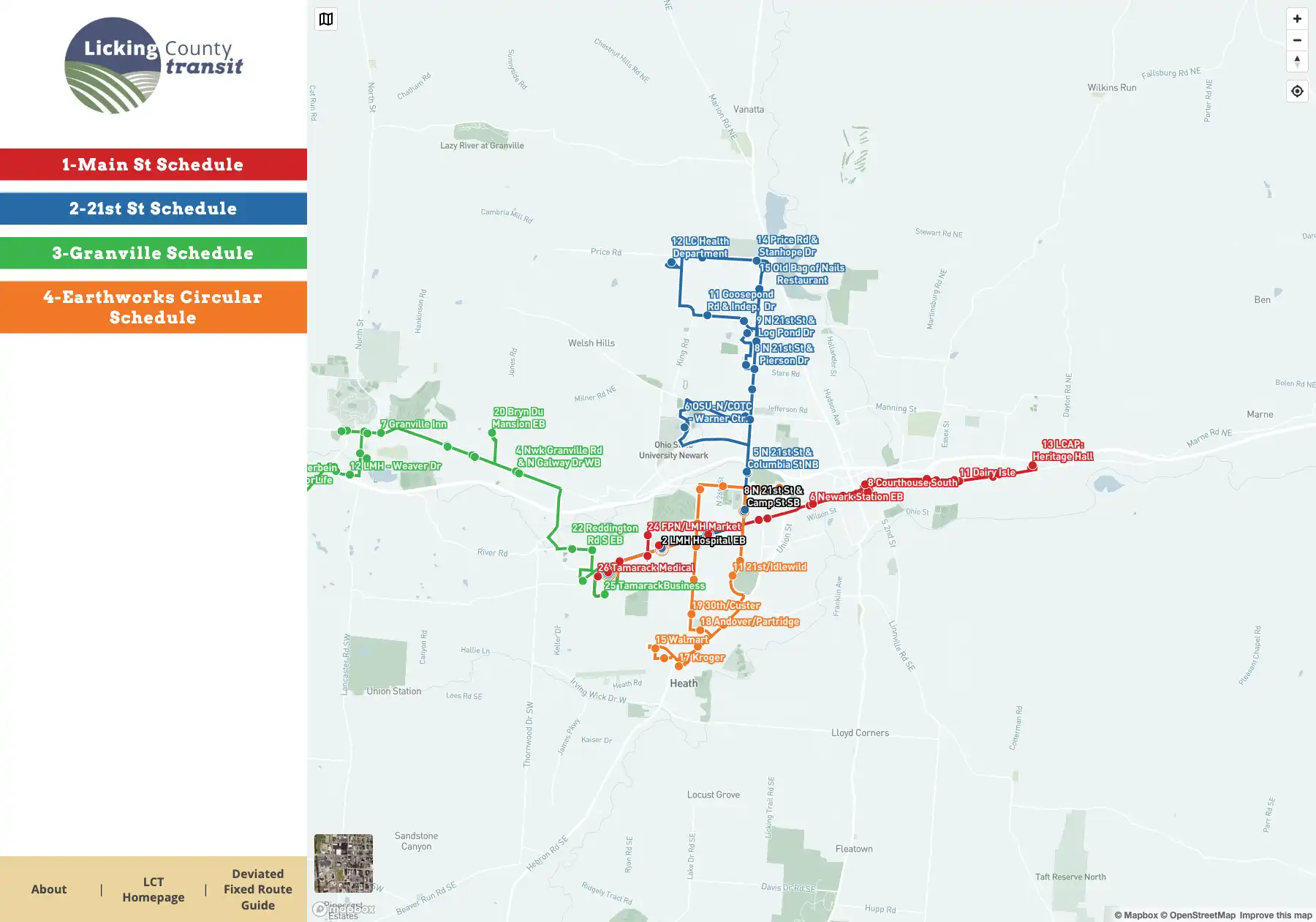
Transit Map
Client Project | A Next JS app that generates a transit map from
GTFS data. Developed along with Etch.
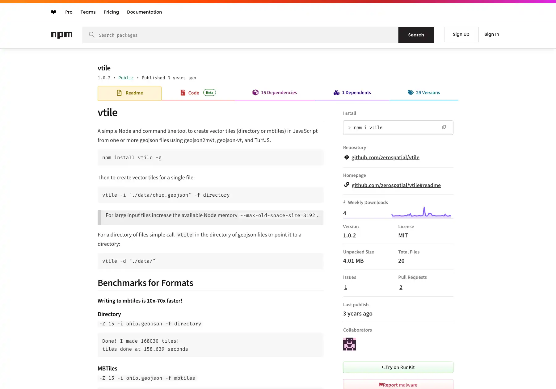
vtile
A command-line tool for generating vector tiles from GeoJSON.
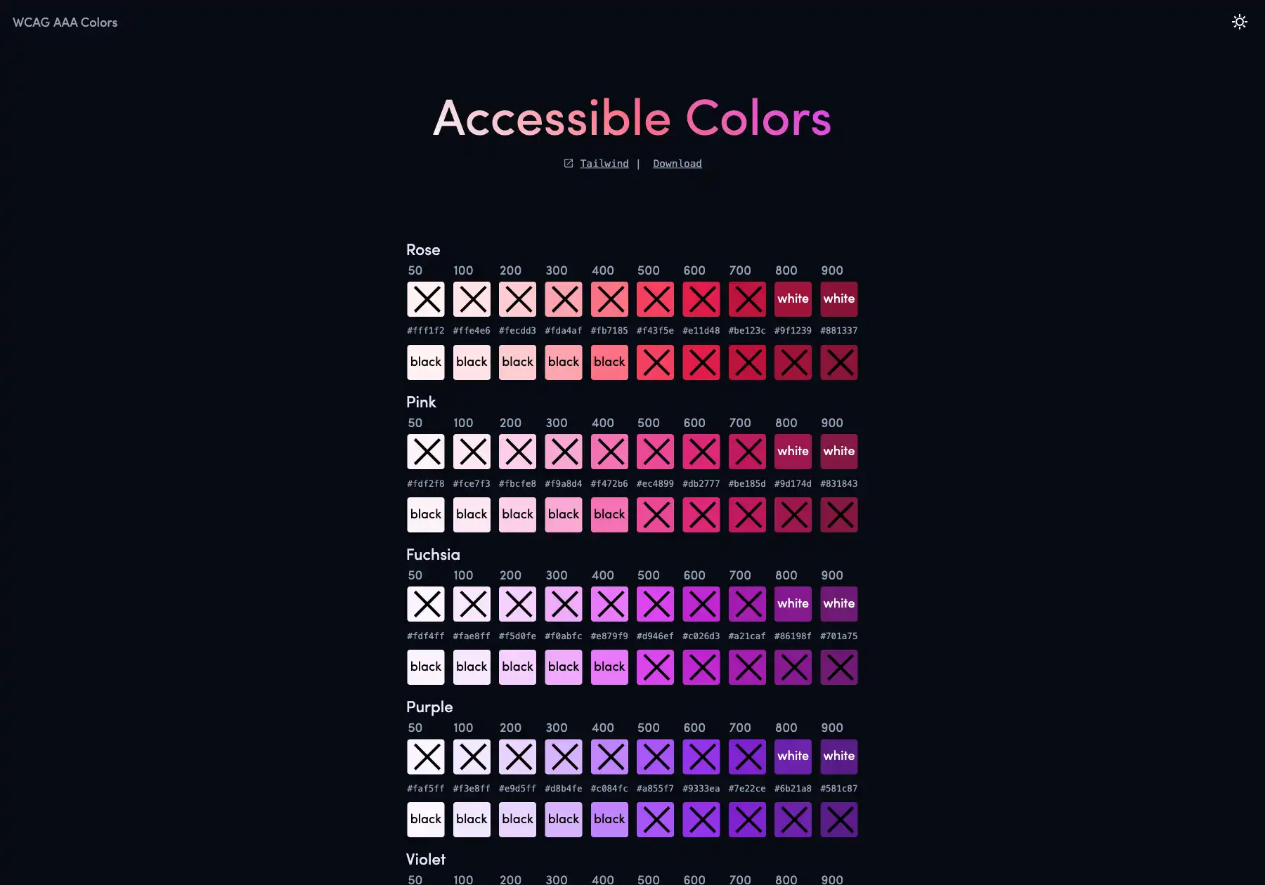
wcag-colors
A color pallette with WCAG contrast ratios.
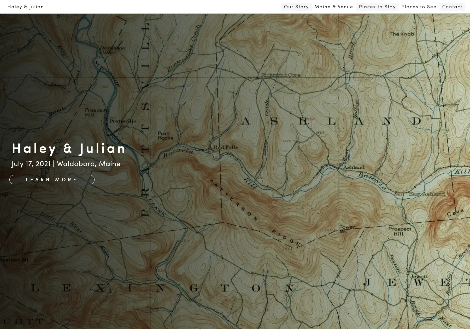
Wedding Website
Client Project | A custom wedding website with an embedded map.